This was my hiking bucket list for 2011. I completed 17 out of the 32 hikes on my list. :-)
Diosbud Creek
Roundtrip: 2-3 miles
Difficulty: ???
Drive time (from N. Everett): 1 hour 30 minutes
Parking Pass required: No
Coal Creek Parkway Trail - Directions and map for Cougar Mountain Regional Wildlife Park ~done
Roundtrip: 4.3 miles
Difficulty: Easy to moderate
Drive time (from N. Everett): 45 minutes
Parking Pass required: No
Mercer Slough Nature Park ~done
Rountrip: 6 miles of trails
Difficulty: Easy
Drive time (from N. Everett): 40 minutes
Parking Pass required: No
Cumberland Creek - Rasar State Park ~done
Roundtrip: Approx. 3 miles
Difficulty: Easy to moderate
Drive time (from N. Everett): 1 hour 15 minutes
Parking Pass required: No
Buck Island - Lewis Street Park - Trailhead ~done
Rountrip: up to 3.5 miles
Difficulty: Easy
Drive time (from N. Everett): 25 minutes -
Parking Pass required: No
Whitehorse Trail ~done
Roundtrip: Variable - up to 12 miles round trip
Difficulty: easy
Drive time (from N. Everett): 55 minutes
Parking Pass required: No
River Meadows Park ~done
Roundtrip: up to 6 miles
Difficulty: easy to moderate
Drive time (from N. Everett): 40 minutes
Parking Pass required: No
Paradise Valley Conservation Area - Woodinville ~done
Roundtrip: 13+ miles of trails
Difficulty: Easy to moderate
Drive time (from N. Everett): 35 minutes
Parking Pass required: No
Old Robe Canyon Trail ~done
Rountrip: 2 miles
Difficulty: moderate
Drive time (from N. Everett): 45 minutes
Parking Pass required: No
Lime Kiln Trail ~done
Rountrip: 7 miles
Difficulty: moderate
Drive time (from N. Everett): 35 minutes
Parking Pass required: No
Old Sauk River Trail ~done
Roundtrip: 6 miles
Difficulty: easy - moderate
Drive time (from N. Everett): 1 hour 15 minutes
Parking Pass required: Recreation Pass required
Tiger Mountain Trail - Issaquah, WA
Roundtrip: ???
Difficulty: moderate to difficult
Drive time (from N. Everett): 1 hour 10 minutes
Parking Pass required: No ??
Pinnacle and Bear Lake
Roundtrip: 4.2 miles
Difficulty: Difficult
Drive time (from N. Everett): 1 hour 10 minutes
Parking Pass required: Recreation Pass required
Canyon Lake - WTA Trip reports - *call to check on forest road condition* Forest service link to hike
Roundtrip: 4.2 miles ??? + have to walk in on FS Rd. 4111 for 2 miles
Difficulty: moderate
Drive time (from N. Everett):
Parking Pass required: No - Call to double check Darrington Ranger District office at 360-436-1155 or Verlot Public Service Center at 360-691-7791
Explorer Falls - Waterfalls Northwest link ~done
Roundtrip: 2.5 - 5 miles
Difficulty: moderate
Drive time (from N. Everett): 50 minutes
Parking Pass required: No
St. Edwards State Park - Printable trail map
Roundtrip: Variable - approx. 6 miles of trails
Difficulty: Easy - difficult
Drive time (from N. Everett): 35 minutes
Parking Pass required: Yes - Discover Pass
Carkeek Park ~done
Roundtrip: 6 miles
Difficulty: easy - moderate
Drive time (from N. Everett): 35 minutes
Parking Pass required: No
Redmond Watershed Preserve
Roundtrip: 2-4 miles
Difficulty: Easy - moderate
Drive time (from N. Everett): 45 minutes approx.
Parking Pass required: No
Lake Twenty-Two ~done
Roundtrip: 4-5 miles roundtrip
Difficulty: moderate - steep
Drive time (from N. Everett): one hour approx.
Parking Pass required: Recreation Pass required
Peek-a-Boo Lake -* Timber sale activity on road 2083 & 2084. Watch for logging trucks. * Forest Service link ~done
Roundtrip: 5 miles
Difficulty: Steep - difficult
Drive time (from N. Everett): 1 hour 45 minutes - best approx.
Parking Pass required: No
Ashland Lakes ~done
Roundtrip: 5.5 miles
Difficulty: easy terrain - longer distance though
Drive time (from N. Everett): 1 hour 15 minutes
Parking Pass required: No
Forks of Canyon Creek - Call to check on forest service road conditions Darrington Ranger District office at 360-436-1155 or Verlot Public Service Center at 360-691-7791
Roundtrip: 4 miles
Difficulty: Difficult
Drive time (from N. Everett): 1 hour approx.
Parking Pass required: No
Iron Goat Trail
Roundtrip: Variable - up to 10+ miles
Difficulty: Moderate
Drive time (from N. Everett): 1 hour 20 minutes approx to Iron Goat Trail Interpretive Site Trailhead
Parking Pass required: Recreation Pass required
Johnson Ridge
Roundtrip: Sunrise Mountain - 4 miles approx. ~ Scorpion Mountain 9 miles approx.
Difficulty: Difficult - Steep
Drive time (from N. Everett): 1 hour 20 min. approx.
Parking Pass required: Recreation Pass is required
Sauk Mountain
Roundtrip: 4.2 miles
Difficulty: moderate to difficult
Drive time (from N. Everett): 1 hour 50 minutes
Parking Pass required: No
Franklin Falls
Roundtrip: 2 miles
Difficulty: easy
Drive time (from N. Everett): 1 hour 25 minutes
Parking Pass required: Recreation Pass required
Twin Falls
Roundtrip: 3 miles
Difficulty: easy - moderate
Drive time (from N. Everett): 1 hour and 10 minutes
Parking Pass required: No
Bridal Veil Falls ~done
Roundtrip: 5 miles
Difficulty: moderate
Drive time (from N. Everett): 50 minutes
Parking Pass required: Recreation Pass required
Boulder River ~done
Roundtrip: 2.5 to 8.6 miles
Difficulty: easy to moderate
Drive time (from N. Everett): 1 hour 10 minutes
Parking Pass required: No
Winchester Mountain Lookout
Roundtrip: 3.5 - 6 miles
Difficulty: difficult
Drive time (from N. Everett): 2 hours 45 minutes
Parking Pass required: Recreation Pass required
Talapus Lake Trail - WTA link
Round trip: 4 miles
Difficulty: Difficult - steep
Drive time (from N. Everett): 1hour 20 minutes approx.
Parking Pass required: Recreation Pass required
Little Mountain Park - Mt.Vernon - WTA link
Roundtrip: variable
Difficulty: easy to difficult
Drive time (from N. Everett): 40 minutes
Parking Pass required: No
Thursday, February 24, 2011
Saturday, February 12, 2011
Winter Wallace Falls hike on a beautiful day!
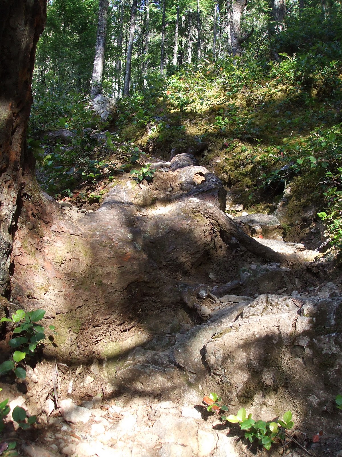
On Wednesday of this last week (February 9, 2011) we went to Wallace Falls State Park and hiked to the upper falls. This is a great 5.5 - 6 mile round trip hike if you follow the woody trail that follows the river. If you opt for the railroad grade trail which is a flat and straight you add another mile each direction. We followed the woody trail both ways and enjoyed the sights and sounds of the river along the way. There were birds out along the trail; I didn't see any, but heard lots of them. The sun was out the whole way and it was so nice to hike on a sunny day and not overheat! There were 3 families with 2 boys each, so there was plenty of energy and running on the trail...especially on the downhill parts! There were a few muddy spots on the trail and the boardwalk areas were slippery, so be careful. This makes a great hike any time of the year!
Check out the carving of a fish that someone made out of a tree stump along this loop.

 |
| At the trailhead...just starting out. |
The trail is about 45 minutes from North Everett. You get on Highway 2 going east and follow it until you get into Gold Bar and then follow the signs for Wallace Falls State Park - it will be a left turn off hwy 2 as you are heading east. The rest of the way is well signed, so just continue to follow the signs to Wallace Falls State Park. Park in the parking lot, as the Wallace Falls Trail starts from there. Water and bathrooms (with flush toilets :) are available at the trailhead!
 |
| The first part of the trail.... |
Follow the trail out of the parking lot until you get to the signs that direct you to the woody trail or the railroad grade trail.....both will take you to the falls, just remember that the railroad grade will add approx. 1 mile to your hike each direction that you take.
 |
| Here is the cutoff to the woody trail...this keeps the bikes off the woody trail and only on the railroad grade trail where they are allowed. |
There are lots of benches along the trail that you can stop and rest on. A short way into the woody trail there is a sign for Small Falls. If you follow the trail to the left you can see the falls and take a short loop trail where the boys scouts have put in a small amphitheater.
 |
| Small Falls |
 |
| Fish carving on Small Falls loop |
After you are done checking out Small Falls, head back out to the main trail and continue up to the lower falls.
 |
| One of a couple of bridges on the trail. |
 |
| A bench looking out over the river....check out the sunshine! |
 |
| Crossing another bridge and ready for lunch! The kids were ready for lunch five minutes into the hike! |
 |
| Another view of the river... |
There is a nice covered picnic area at the lower falls with tables and a viewing area of the falls. If you have smaller children or are ready to quit here....this makes a great hike by itself!
 |
| Lower Falls |
We always eat our lunch at the picnic area here. If you have more energy or are just itching to check out the rest of the falls, continue on up the trail. The trail is steeper from this point on with lots of switchbacks, but it is well worth it in my opinion. There are several lookouts along the way with stops for the Middle Falls and one last stop for the Upper Falls, both of these are signed, so you will know when you get there.
 |
| One of the views of the falls... |
 |
| All the boys posing at one of the lookouts! |
 |
| Another lookout.... |
 |
| This was at Upper Falls....the breeze started blowing the mist from the falls over my head and I caught it in the sunlight! |
 |
| View of the snowline from one of the lookouts. |
 |
| View |
 |
| Sitting on a bench enjoying one of the lookouts. |
 |
| I happened to stop and look up while I was walking and thought it was a nice view....so I'm sharing it with you! |
 |
| Middle Falls |

 |
| View from the beginning (or end) of the trail.... |
Don't miss any of the lookouts along the way as each one offers a different view including a lovely lookout where you can see for miles if the weather is clear. The trail does continue on past the Upper Falls, with a warning not to continue unless you know where you are going. I would advise the same. The trail gets rougher from here and would take some good navigation skills to continue. There is a story on an information board at the Upper Falls about two women who continued on and were lost for 48 hours before search and rescue found them.
 |
| Posing at the information board at Upper Falls. Some people's children pose more than others....who do those kids belong to? |
It's a good reminder to be prepared when you are hiking anywhere and to make sure you know where you are going! Washington Trails Association has excellent hiking preparation information, so make sure you are prepared next time you go!
 |
| I took this as we were leaving Gold Bar....I just thought it was too pretty to pass up! |
Sunday, January 30, 2011
Western Washington hiking list ~ 2010

I decided to compile a list of hikes that I did last year. Not only the hikes that I did with my homeschooling friends, but also some that we did as a family. Here goes....
Little Cranberry Lake - Anacortes, WA ~ From what I can remember parking was limited. This was a great place to hike around and explore. There is an old mining (?) cave that you go into a ways - then it is blocked off. Lots of connecting trails to hike on. Great family hike!
 |
| This is the entrance to the cave |
 |
| Cranberry Lake |
 Lord's Hill - Snohomish, WA ~ One of the best hike's in Snohomish county if you don't want to drive forever to get there. Plenty of parking. Lots of different trails to check out. Several view spots. Some of the trails are used by mountain bikes and horses, so exercise caution.
 Narbeck Wetland Sanctuary - Paine Field, WA ~ A nice short nature walk very close to Boeing's Paine field. Just short of 2 miles of trails with interpretive signs and a chance to see ducks, beavers and other wildlife, and nice spots to sit and enjoy your lunch! The parking lot can be crowded with Boeing employees who come to smoke because they are not allowed to smoke on Boeing property. Parking is available on the street as well, if the parking lot is full.
Ashland Lakes - on a FS road just past the Verlot Ranger Station ~ This is a beautiful hike with lots of boardwalks. There are campsites by the lakes as well if you like backpacking.
 |
| Here is one of the boardwalks...with the kids trying not to fall in... :-) |
 |
| One of the Ashland Lakes |
Wallace Falls - Gold Bar, WA ~ This hike is that starts at Wallace Falls State Park. It has beautiful scenery throughout. There are two routes that you can take to reach the lower falls. A railroad grade trail or a more rugged trail along the river. From the lower falls you can choose whether to hike on to the middle and upper falls.
 |
| Lower Falls |
 |
| Middle Falls |
 |
| Middle Falls with very tired children |
 |
| Upper Falls |
Boardman Lake - Just past the Verlot Ranger Station on a FS road ~ This is a wonderful short hike that almost anyone could do....it's only 2 miles round trip. A beautiful lake at the end, that can be good for a cooling swim if the weather is warm. Be warned that it can be very buggy though. There are campsites at the lake as well as a pit toilet. Lake Evan is about .1 miles into the hike and is beautiful as well!
 |
| Lake Evan |
 |
| Lake Evan |
 |
| Some beautiful lichen near Boardman Lake |
 |
| Boardman Lake |
 |
| The skunk cabbage was HUGE! |
 |
| Here's the big stream crossing. The big decision was - to remove the shoes or not? |
 |
| A wild violet of some sort... |
 |
| Cool shelf fungus |
| Photo of Feature Show Falls by Dan Yates |
Boulder River - between Arlington and Darrington off SR 530 ~ This is a fun hike with easy access to the river and a nice view of a couple of small waterfalls. We only hiked about 2 - 2 1/2 miles and turned around.
Lake Twenty-Two - Near the Verlot Ranger Station ~ We went on this hike on a VERY warm day! Everyone was hot, and cooled themselves in every little stream or damp area we passed! The lake itself has a really nice boardwalk that partially surrounds it and is nice for wading into and cooling off! We ate lunch on the boardwalk and the kids waded in the water. I made sure to soak my hat and my long sleeved shirt in the water before we left and it was dry by the time we got back to the parking lot!
 |
| Columbine |
 |
| Lake Twenty - Two |
 |
| The kids playing in the water...they didn't like the squishy bottom of the lake though! |
Redmond Watershed Preserve - Redmond, WA ~ This is a nice trail system right in the midst of Redmond! It has a couple of short nature loop trails with interpretive signs and some longer trails. You could probably get between 2 and 3 miles of walking out of the trails if you hit them all. I really liked this article for advice on the different trails within the preserve.
Barclay Lake - Baring, WA ~ This is a pretty easy, not too long trail - a little over 4 miles with another gorgeous lake at the end. A great little beach on the lake for sitting and eating your lunch, as well as water for the kids to put their feet in if it's a warm day. Not to mention the gorgeous view across the lake.
 |
| Barclay Lake....the kids got more than their feet wet....this is why I always pack a towel and change of clothes for my kids when we hike! :-) |
 |
| Getting wet...they don't look like they are enjoying it at all, do they? |
 |
| The view across Barclay Lake |
 |
| The perfect picture log... |
 |
| Isn't this a great log? |
Lime Kiln - Granite Falls, WA ~ This is a beautiful hike with a great little historical factor built in! The sign at the trailhead gives info about what the Lime Kiln is, when it was built, etc. You can see historical artifacts along the trail, as well as the old Lime Kiln. Also, there are great berries along the trail if you are there at the right part of the year! Don't forget that the artifacts are there for everyone to see and enjoy. So, please don't touch, move or remove any of them. Because this is a historical preserve it is against the law to do so.
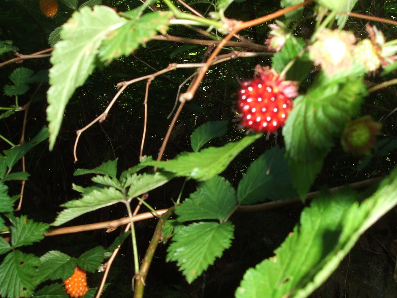 |
| Some delicious Salmon Berries! Best I've ever tasted (and I am quite the berry sampler)! |
 |
| Holding up a tree on the trail :) |
 |
| Some of the artifacts along the trail. |

 |
| All my boys in front of the kiln. |
 |
| One of the old bricks that had fallen off the kiln. |
 |
| Inside the lime kiln. |
Southwest County Park - Edmonds, WA ~ This is another one of those in town nature walks that is nice because you don't have to drive far! There are trails on BOTH sides of the road, so make sure to explore both sides! We found a great rope swing on the trail during our exploration! The kids had a blast! We also found a pair of mating slugs, so we got our science lesson in for the day!
 |
| Here are the mating slugs....sorry slugs...no privacy.... :-) |
 |
| Here is the great rope swing that we found! |
Explorer Falls - Lake Roesiger, WA ~ This is an interesting little hike that takes you on a walk up a graveled road for most of the hike, you cut off after about a mile and cross a creek to get to the falls. The day we went was drizzly. We ate lunch on the rocks between the creek and the falls. It was really pretty and nice to be able to get so close to the falls! The trail continues from right where you crossed over the creek and goes up farther and there is supposed to be a rough shelter that the boy scouts built somewhere up there. Due to the rain we didn't explore any farther up the trail....but will definitely be back to check it out at a later date!
 |
| Explorer Falls - Kids trying to get as close as they can...they were already soaked from the rain! |
 |
| Explorer Falls |
Bridal Veil Falls - near Index, WA ~ These are beautiful falls! The hike is not too difficult and is a great family hike. Definitely keep an eye on your kids as there are some steep spots on the trail and you have very close access to the falls. Popular trail with lots of parking, you can continue farther along the trail to Lake Serene. The hike to Bridal Veil Falls is about 5 miles round trip and was enough of a hike for us the day we went!
 |
| Here is a nice viewpoint along the trail |
 |
| Bridal Veil Falls - as you can see you are RIGHT next to the falls! |
 |
| Bridal Veil Falls |
 |
| Along the trail.... |
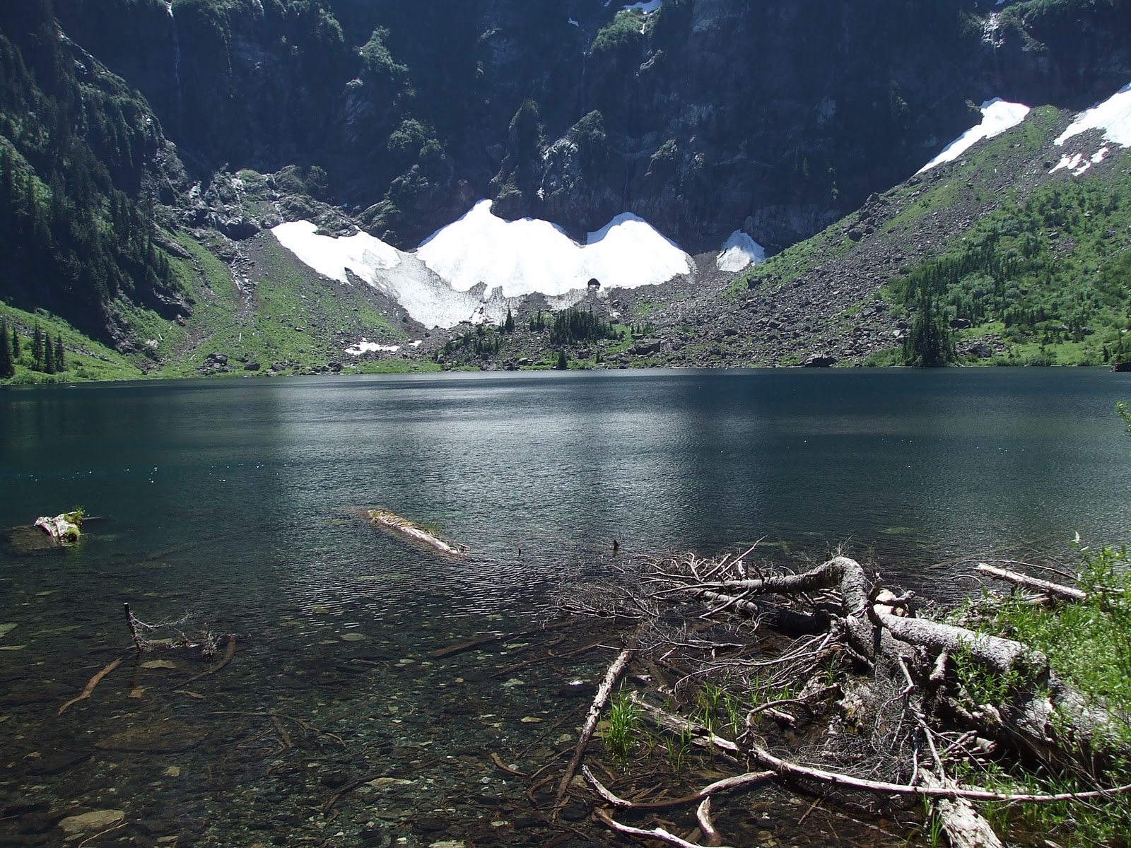
Pyramid Lake - Near Diablo Dam ~ This was probably the most strenuous hike that we went on this year! 4.5 miles round trip and 1500 ft. elevation gain, but I really loved it! The journey itself was part of the reward....the hike is beautiful...the lake (sometimes referred to as Pyramid puddle, due to it's size) is gorgeous despite it's small size! My kids were tired and complained some a long the way, but it was well worth it! There were so many pretty plants to see a long the way!

 |
| Here is the trail head |
 |
| This is how I did part of the first mile of the hike....with a cranky, crying child on my back. |

 |
| Pretty sure that this is Lilium Columbianum or Tiger Lily... |
 |
| I think that this is Corallorhiza Mertensiana or Western Coralroot which is in the orchid family. |
 |
| This is was my most prized find, which I am pretty sure is Monotropa Uniflora or Indian Pipe. |
 |
| Pyramid Lake |
 |
| Donovan on a log |
 |
| Pyramid Lake |
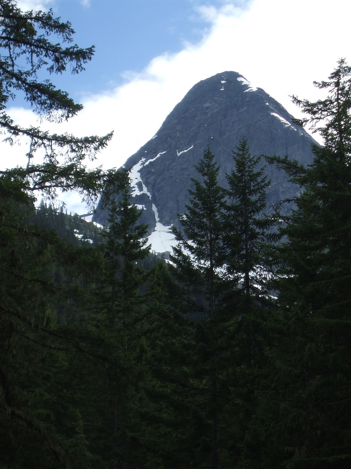 |
| View from the trail - I think this is Pyramid Peak... |
 |
| The trail was steep and rough in places... |
Thunderknob Trail - Colonial Creek Campground - Ross Lake National Recreation Area ~ This is a hike with incredible views at the end of the hike! It isn't too long and has a few nice stopping points along the way to rest and have lunch. There is a pretty pond about half way up to the top and beautiful views of Diablo Lake and Dam at the end of the hike!
 |
| Beautiful view of Diablo Lake |
 |
| Diablo Lake view |
 |
| My husband taking his typical 10 minute nap on a bench at the end of the hike! |
 |
| Our favorite sitting tree... |
 |
| Just like riding a horse....tree.... :-) |
Heybrook Lookout - Near Index, WA ~ This is a hike that goes up to the Heybrook fire lookout. It is fairly steep, but is not too long....so I guess that makes up for the steep part... :-) The view is beautiful! The tower itself is enough to make your palms sweat if you don't like heights. I was a nervous wreck while we were up in the tower and was ready to get back on solid ground! It is the shortest hike to a fire lookout in the area though, so if you are itching to visit one, this is the one to do!
 |
| This was a great looking rock along the trail that had fern and moss hair. Someone had drawn a face on it with a piece of bark or soft rock. |
 |
| Climbing the perfect sliding rock! |
 |
| On your marks, get set, GO! |
 |
| At the top of Heybrook Lookout |
 |
| The view from the Heybrook Lookout fire tower. |
 |
| Here is the view of the lookout as you approach on the trail. |
 |
| At the base of the lookout with my boys and our sweet, tired, hot, old dog! Check out the red faces, It was in the 90's that day and we were WARM! |
Deception Falls - 10 mi. East of Skyomish ~ This is a short little nature trail....it's a great stop for stretching your legs and getting some fresh air if nothing else!
 |
| The sign from the road...it's easy to miss! |
 |
| Nap time again! This time it's a log.... :-) |
 |
| This was a really cool tree that Donovan found that was hollow in side. |
 |
| Here is how tall the tree was. |
 |
| Here is the hollow part inside. |
 |
| The kids had fun crossing the stream and playing in the water...it was really cold though! |
 |
| The dog...getting a drink again. |
 |
| The steps up to the falls.....my kids can never utilize the proper method for climbing stairs.... |
 |
| Deception Falls... |
Jetty Island - Everett, WA ~ Jetty Island is one of Everett's gems! A great place to play and explore a sand beach, tide flats and much more! Several miles of walking paths....many with interpretive signs. Jetty Island is free to visit, but they do appreciate donations to help keep things operating! You take a short 5 minute ferry ride over. If you live within the city of Everett, or you want to bring a large group, you can call ahead to make ferry reservations. There are many days that the ferry's are booked ahead....so plan accordingly!
 |
| Enjoying the sand! |
 |
| Getting off the ferry... |
Iron Goat Trail - Highway 2 near the Summit ~ This is a great history lesson as well as a great hiking area! There are several access points/trailheads. So much to explore and highly recommended! Check the link out before you go to figure out which trailhead you want to start from. We started at the Wellington Trailhead when we went.
 |
| One of the old train tunnels...due to it's instability and tendency to flood you can't enter it. |
 |
| Our old dog getting a drink in the stream. |
 |
| Having lunch...I must have brought something exciting by the look on their faces.... :-) |
 |
| One of the interpretive signs at the sight of the Wellington avalanche disaster that tells the story. |
 |
| Inside the snow shed that was built to protect the trains from avalanches after the Wellington disaster. The trail goes for a mile inside the snow shed...it was nice and cool on a hot day! |
Carkeek Park - North Seattle ~ This is another close to home park with great trails! 6 miles of looping trails and lots to see. Make sure to check out the great, old apple orchard too!
 |
| Map of all of the trails! You can find this map on the link above. |
| This is the orchard.... |
 St. Edwards State Park - Kenmmore, WA ~ 7 miles of trails, some steep, some easy, with access to the lake. Very nice trails, lots to see and not too far to drive! You can play at the awesome park after you are done hiking if you have time!
 Whitehorse Trail - Arlington, WA at Swede Heaven Rd. ~ You can
 access the trailhead for the 6 miles of trails that are currently open by turning North off of SR530 onto Swede Heaven Rd. The signed trailhead is about 1/2 - 3/4 of a mile down Swede Heaven Rd on the right hand side. Not a lot of parking at the trailhead, but you can park on the corner of SR 530 and Swede Heaven Rd. and walk on the road to the trailhead. This was a beautiful fall hike, lots of leaves! This is a rails to trail - trail so it is nice and flat.
River Meadows - Arlington, WA ~ There are about 6 miles of hiking trails in this nice Snohomish county park. Nice dirt trails through the woods and along the river. After you enter the park, take your first left and continue down the road until you get to another parking area and park here. There is a signpost that has a map of the trails here and you can start hiking from the edge of the parking lot.
 |
| There was a big dirt mound near the parking lot that the kids played on while they were waiting for us to finish getting ready . |
 |
| We at lunch on the river bank.....as you can see it was a beautiful day! |
Well, this concludes our hikes for 2010! I was shocked that there was so many! 26 in all! Hope you enjoy looking them over and doing some of them yourselves! Can't wait to get more hiking done in 2011!
Subscribe to:
Posts (Atom)