Friday, June 27, 2014

Japanese Gulch Trail - June 26, 2014

We went on another short, but nice hike on the Japanese Gulch Trail in Mukilteo this week. We walked between 2 1/2 and 3 miles and spent about an hour and a half divided between walking and eating lunch. There have been many improvements to the trail since the last time I visited. You no longer have to pull yourself up a steep hill with a rope. This section was replaced by stairs. There are many other muddy or steep areas that now have wooden boardwalks or bridges. We also decided to check out the 1/4 mile interpretive trail on the opposite side (North) of the road from the main Japanese Gulch site (where the dog park is). This trail begins a little bit east of the main site and dead-ends at Mukilteo Lane. Nice interpretive signs and lots of berries ripe at the time I hiked, both huckleberries and thimble berries.

A bumblebee visiting some St. John's Wort near the trailhead.


The only fungus picture I took

Western Tiger Swallowtail

Ripe Thimbleberries 
Happy summer hiking!

Friday, April 4, 2014

Trail closure - Lime Kiln Trail

**Update as of 7/29/2014 - According to many trip reports on WTA.org, the trail is not closed 2 miles in, despite signs (and the Snohomish County Parks website) saying otherwise. Many reviewers hiked the trail with children and had no problem with the trail conditions. Keep in mind that there are steep, narrow parts along the trail, so make sure to supervise your kids to avoid accidents. :-)
I ran across this trail closure today and wanted to let you know about it. The Snohomish County Parks and Rec page has the following posted about the Lime Kiln Trail:

* TRAIL ADVISORY *     DUE TO SLIDES AND UNSTABLE CONDITIONS,THE LIME KILN TRAIL IS CLOSED FOR ALL USE AT THE WASH OUT AT APPROXIMATELY 2 MILES IN.  THE BRIDGE, NEAR THAT LOCATION, WILL ALSO BE CLOSED FOR MAINTENANCE APRIL 14th-18th, 2014

This is a fabulous trail and I hope that they are able to get a safe path around the slide area soon! I would check the Snohomish County Parks and Rec Page or the Lime Kiln Trail Reports on the WTA site for updated info.

Here is a picture of the lime kiln from the last time we hiked there in 2012.
Stay safe!

Lord Hill Regional Park ~ March 25, 2014

I know I haven't been posting much lately. I'm in college full time as well as homeschooling my two boys so there hasn't been as much time for hiking lately. We did manage to get out once during my spring break. We went to one of my favorite local places, Lord Hill Regional Park. We originally decided not to go in the morning because it was pretty wet outside. Around noon, the weather was looking okay, so we changed our minds and decided to head out. It (of course) started raining on the way there and continued for the first 30 minutes of hiking. The trails were muddy, but we came prepared with boots and/or shoes that could get dirty. We only saw a couple of other people who ventured out in the rain on the trail that day.

You can see my son is somewhat drenched from the rain.
 We went up to the lookout off of the pipeline cutoff trail (my favorite lookout, and a great place to eat lunch). We stopped to have something to eat under some trees that were keeping us drier. After we'd been there for about 15 minutes, the rain stopped and some blue sky started peeking through the clouds!

The view from the lookout.

I loved the way the water on this lichen was catching the sun.

We even found a snake sunning himself along side the trail on the way back to the car.

We saw some  flowers, including skunk cabbage, announcing that spring had arrived.

Salmon berries are in bloom. 

Trillium was up and blooming as well. 
It was nice to be out and get some exercise and fresh air. The flowers and sunshine were a nice reward too!
I'm taking the summer off from school so I should have more time to hike and will try to blog the hikes that we do over the summer.

Happy Trail!


Friday, March 29, 2013

Japanese Gulch ~ March 26, 2013

We went on a short hike at Japanese Gulch in Mukilteo this last week. Here is a link to a map of the trails at Japanese Gulch. I would take the time to look over it so you have a general idea of where you would like to go. The first time that we went on this trail, I brought a map along, but because the trails are not marked and there are a lot of branching trails it was hard to tell exactly which trail you were on.

We parked in the dog park parking lot and accessed the trail on the west side of the dog park. We hiked south and then came down into the gulch, crossed the creek and followed the trail along the railroad tracks north and came back up on the east side of the dog park parking lot.

There are some ups and down and elevation changes and lots of mud (I'd recommend waterproof hiking boots)! We went during the week and didn't see any bicycles, but the trails are used by both hikers and mountain bikers. I wouldn't recommend the trail for anyone that doesn't have good balance or is unsteady, as there are a few bridges and crossings that require some balancing. That said, this is another great, local hike! We probably went about 3-4 miles and enjoyed the nice sunny day.

Here are some picture highlights from the hike:

More favorite signs of spring, Salmonberry blossoms!

My son enjoying a nice seat on a tree
 It wouldn't be a hike without some fungus pictures!


A beautiful view of the water from the trail

Happy Spring trails to you!

Lake Cassidy ~ March 17, 2013

We checked out this short hike that Craig Romano posted as his Hike of the Week for March 15, 2013.
It's located in Marysville, Washington and makes a fun, quick hike that you don't have to drive very far to get to. Check out Craig's post in the link above for directions. He also gives directions to the ADA parking area that makes this lake accessible to disabled hikers.

The day that we went it started hailing in the middle of our walk. Luckily the hail didn't last long!

You can see some of the hail in this picture

This hike is part of the Centennial Trail and is a paved, level trail used by bicyclists and pedestrians.

After 1 1/4 miles Lake Cassidy appears through the trees.

Here's the first view of the lake from the trail

There is a picnic area, educational kiosk and a nice boardwalk when you reach the lake.

Here is a portion of the boardwalk that extends out onto the lake

An eagle that was in a tree near Lake Cassidy

A Red Winged Blackbird singing about spring coming

One of my favorite signs that spring is coming! Skunk Cabbage.
A fungus covered snag
Happy Spring hiking!

Saturday, February 16, 2013

Maple Leaf and Thornton Creek Stairway Walk ~ February 9, 2013

Here are the stairs at the very beginning of the walk that
brought us down from the
bridge at the top of the picture across a green area
and into another neighborhood.


This was one of the Feet First Stairway Walks Day walks. This was the second walk that I've done from the Seattle Stairway Walks book. Unlike the first one of the stairway walks that I did, this one had a guide who already knew the walking area.

Here is our guide Carolyn, giving us some
background about the walk.

This North Seattle walk is 4.7 miles long and takes you through neighborhoods, natural areas, a community pea patch, and an urban area adjacent to the Northgate Mall. You do cross several busier streets, so if you are walking with children, keep this in mind.


Crossing a bridge


Looking down
 One minute you are on the beaten path...and then you are in the middle of nature.


This heron was in one of the wetland areas

I thought it was kind of funny how it looks like the duck is spitting the water out.

A tree that the beavers worked on.


Along the trail

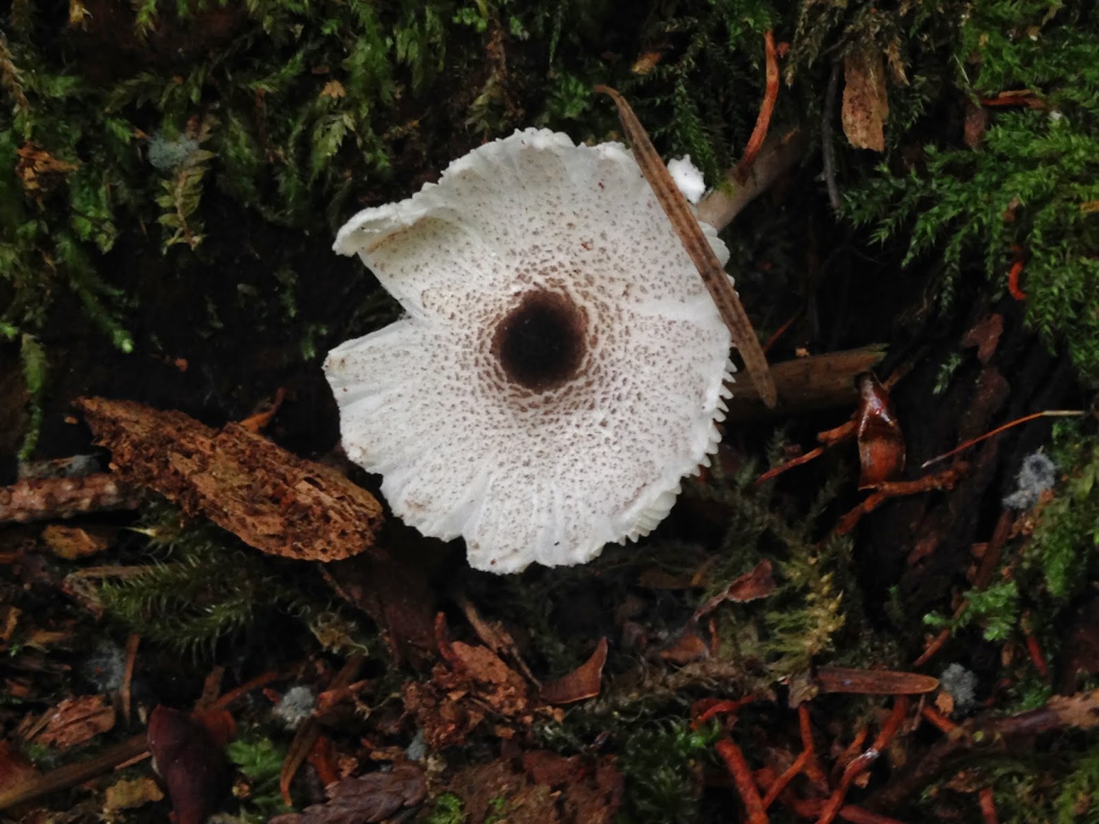
The only fungus I saw

Beautiful red bark


 And then you arrive at the mall! We stopped at The Jewel Box Cafe for a cup of tea and a muffin, as well as a restroom stop before we headed back out again.


 We saw a lot of beautiful art.


This is an area where Thornton Creek runs through the Thornton Place Condominiums.


After leaving the mall we walked through a community pea patch with more artwork and stairs.


 This was an interesting walk. It's kind of fun to see how many natural areas you can find so close to the urban ones.


Happy trails.

P.S. I finally ordered the Stairway Walks Seattle book and should have it soon.
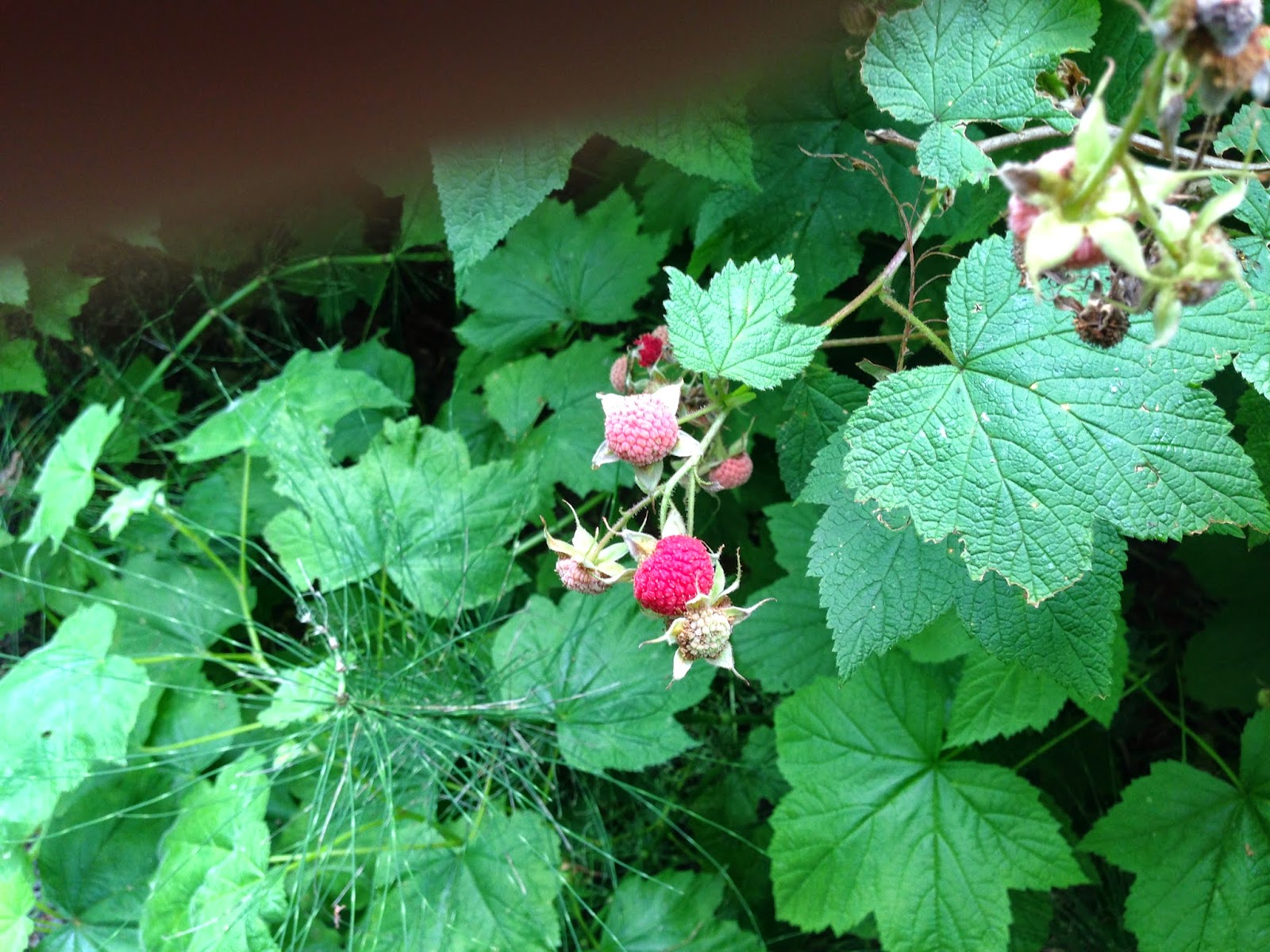
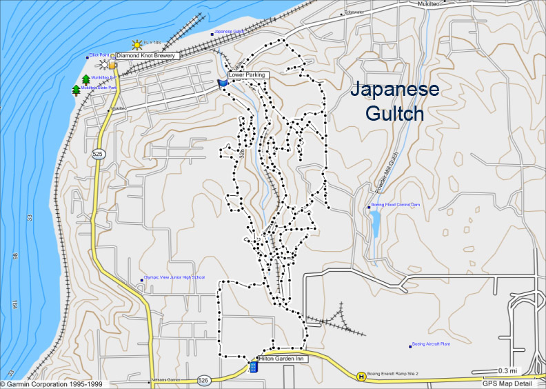
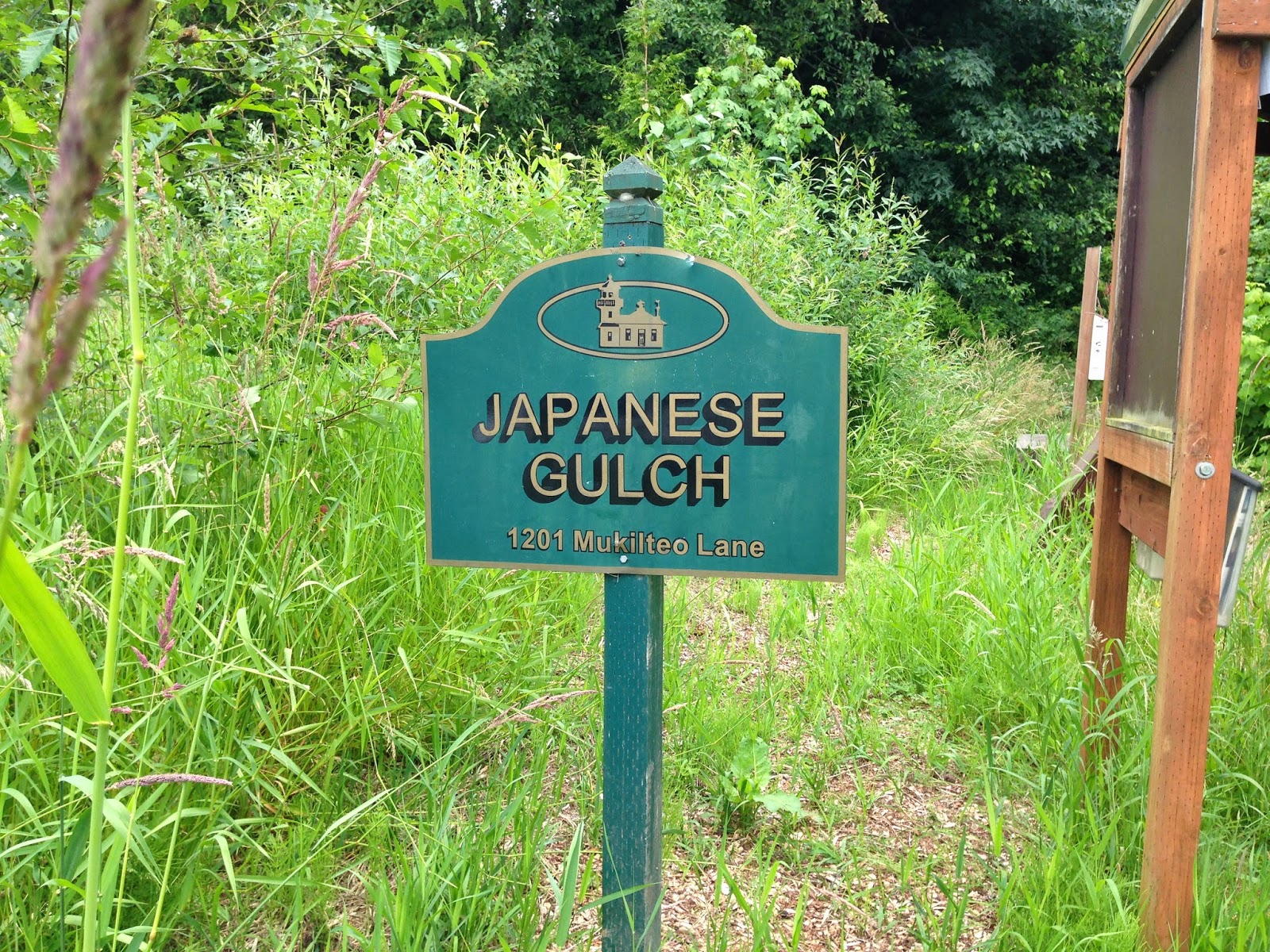


Friday, February 8, 2013

The Olmsted Vision Stairway Walk - Seattle - January 13, 2013


One of several sets of stairs that we walked.

This was a really fun urban walk that I did with a friend. The walk comes from a book called Seattle Stairway Walks An Up And Down Guide To City Neighborhoods. The name of the walk is The Olmsted Vision. This walk takes you through three parks; Washington Park Arboretum, Interlaken Park and Volunteer park. More about the walk in a minute. An interesting Washington State History tie in to my last post about Northern State Hospital. The Olmsted Firm (a very historically significant landscape architecture firm) designed both the grounds of Northern State Hospital and the three parks above as well as other parks and grounds across the country from 1857-1979. Okay, enough history. I just thought it was interesting and had to share.

The whole idea of urban stairway walks is new to me. I had no idea that such a book existed. It's a great way to be able to get your exercise walking in the city, but it's also very similar to hiking with all of the stairs you go up and down.

We parked on a neighborhood street near the Montlake Branch of the Seattle Public Library. We went on a Sunday, so street parking didn't have a time limit. There are public transit options and other parking options listed in the book. If you decide to do this walk or others in the book you will definitely need the book for the maps and details. My local Snohomish County Library has the book and I'm on the waitlist for it now, although I'm thinking about purchasing it.

A beautiful bench along the route


We followed the map and route from the book, walking for a while and then stopping at the Volunteer Park Cafe for a delicious snack (I had coffeecake) and tea. After we finished our snack, we headed back out along the route.


We climbed more stairs...


Soon we arrived at Volunteer Park.


We saw a peek-a-boo view of the Space Needle through a sculpture.


 There wasn't much color out on this cold, winter day, but I spotted these and had to take a picture.


Another, natural set of stairs.


Which brought us to the Volunteer Park Water Tower with more stairs and beautiful views!


Climbing the water tower stairs.


View of the Space Needle from the water tower.


Seattle Skyline from the water tower


St. Joseph Catholic Church in the distance


A beautiful home outside Volunteer Park

Who knew there was an urban mountain bike skills park right under I-5?


A little more winter color I spotted:


Anyone have any idea what this is?


We walked past the Grand Army of the Republic Cemetery. A Civil War cemetery.


Another beautiful view of the Seattle Skyline with the mountains in the background.


Another set of stairs to climb.


 A couple of fungus pictures, just because I couldn't help myself. ;-)


And a pretty piece of glass that I spotted in someone's garden along the way.


I highly recommend giving one of these stairway walks a try. There's no better way to spend a dreary winter day than exploring an interesting area that's close to home.

I'm going on another Stairway Walk this weekend. Stairway Walks Day is happening on Saturday and I'll be going on the Maple Leaf and Thornton Creek walk. I'll blog about it soon and let you know what I thought.

Happy Trails!