Showing posts with label Snohomish County. Show all posts

Friday, April 4, 2014

Lord Hill Regional Park ~ March 25, 2014

I know I haven't been posting much lately. I'm in college full time as well as homeschooling my two boys so there hasn't been as much time for hiking lately. We did manage to get out once during my spring break. We went to one of my favorite local places, Lord Hill Regional Park. We originally decided not to go in the morning because it was pretty wet outside. Around noon, the weather was looking okay, so we changed our minds and decided to head out. It (of course) started raining on the way there and continued for the first 30 minutes of hiking. The trails were muddy, but we came prepared with boots and/or shoes that could get dirty. We only saw a couple of other people who ventured out in the rain on the trail that day.

You can see my son is somewhat drenched from the rain.
 We went up to the lookout off of the pipeline cutoff trail (my favorite lookout, and a great place to eat lunch). We stopped to have something to eat under some trees that were keeping us drier. After we'd been there for about 15 minutes, the rain stopped and some blue sky started peeking through the clouds!

The view from the lookout.

I loved the way the water on this lichen was catching the sun.

We even found a snake sunning himself along side the trail on the way back to the car.

We saw some  flowers, including skunk cabbage, announcing that spring had arrived.

Salmon berries are in bloom. 

Trillium was up and blooming as well. 
It was nice to be out and get some exercise and fresh air. The flowers and sunshine were a nice reward too!
I'm taking the summer off from school so I should have more time to hike and will try to blog the hikes that we do over the summer.

Happy Trail!


Friday, March 29, 2013

Japanese Gulch ~ March 26, 2013

We went on a short hike at Japanese Gulch in Mukilteo this last week. Here is a link to a map of the trails at Japanese Gulch. I would take the time to look over it so you have a general idea of where you would like to go. The first time that we went on this trail, I brought a map along, but because the trails are not marked and there are a lot of branching trails it was hard to tell exactly which trail you were on.

We parked in the dog park parking lot and accessed the trail on the west side of the dog park. We hiked south and then came down into the gulch, crossed the creek and followed the trail along the railroad tracks north and came back up on the east side of the dog park parking lot.

There are some ups and down and elevation changes and lots of mud (I'd recommend waterproof hiking boots)! We went during the week and didn't see any bicycles, but the trails are used by both hikers and mountain bikers. I wouldn't recommend the trail for anyone that doesn't have good balance or is unsteady, as there are a few bridges and crossings that require some balancing. That said, this is another great, local hike! We probably went about 3-4 miles and enjoyed the nice sunny day.

Here are some picture highlights from the hike:

More favorite signs of spring, Salmonberry blossoms!

My son enjoying a nice seat on a tree
 It wouldn't be a hike without some fungus pictures!


A beautiful view of the water from the trail

Happy Spring trails to you!

Monday, June 18, 2012

Lime Kiln Trail - June 14, 2012

**Update as of 7/29/2014 - According to many trip reports on WTA.org, the trail is not closed 2 miles in, despite signs (and the Snohomish County Parks website) saying otherwise. Many reviewers hiked the trail with children and had no problem with the trail conditions. Keep in mind that there are steep, narrow parts along the trail, so make sure to supervise your kids to avoid accidents. :-)

**Update as of 4/4/14 - Trail is closed 2 miles in due to slides and unstable condition. See my post for more info.


Even thought I've hiked 
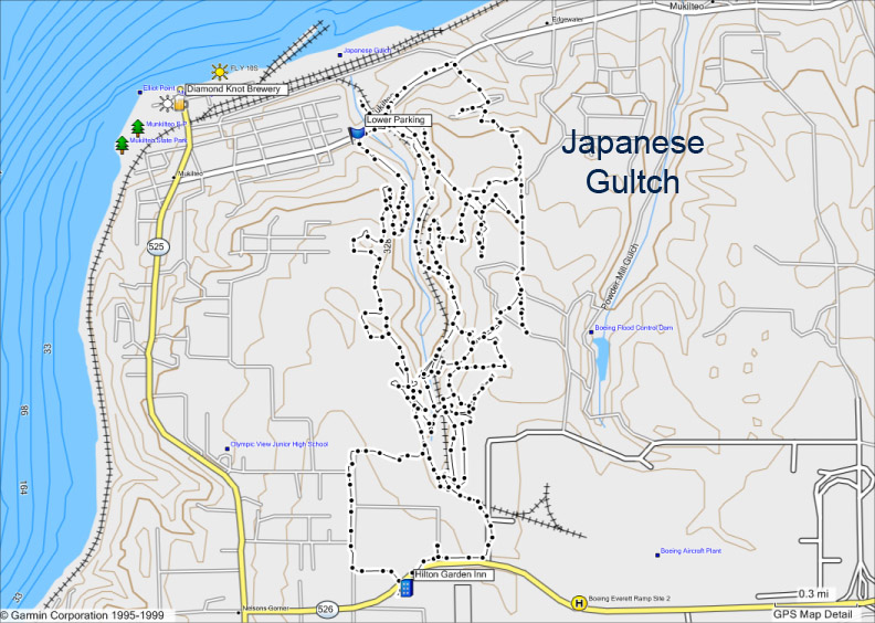
Lime Kiln Trail several time, it's one of my favorites. It's close to home (about 35 minutes from North Everett) and not a difficult trail to hike.

There is a gravel parking area at the trail head and there were 2 vehicles there when we arrived with friends. We hiked on a Thursday, but I'm sure the parking area is busier on the weekends. I did read on the WTA.org website that there have been several car break-ins/prowls over the last couple of months. ALWAYS remove valuables from your vehicle when leaving it at a trail head (car prowls are common at trail heads because there are usually long periods of time where vehicles are left unattended). You can't always avoid the risk of someone breaking into your vehicle, but if there isn't anything visible, I'm sure it lessens the chance. If there isn't anything to steal, it's that much less of a headache for you if someone does break in.

**Update - I forgot to include this when I originally published this post. It's about the washouts along the trail. There has been one main washout along the trail for the past couple of years which has been easily passable. It's still passable, but has washed out a little bit more. There is a new, big slide area, which is easily passable as well. We had a 3 year old and a 6 year old that did fine with parental help. Just wanted to make a note, so that you would  know what to expect on the trail. :)**

Lots of Salmon Berries along the trail! This is my favorite spot for Salmon Berries and I hit them at their prime!


We hiked the whole trail to the riverbank at the end (7 miles round trip). We had lunch on the riverbank. Lots of big rocks to sit on there.

Before you get to the river you will see the old lime kiln and some artifacts. Please leave all artifacts where they are. Here is a link with more history about Robe Canyon Historic Park and the lime kiln.


Here is the old lime kiln

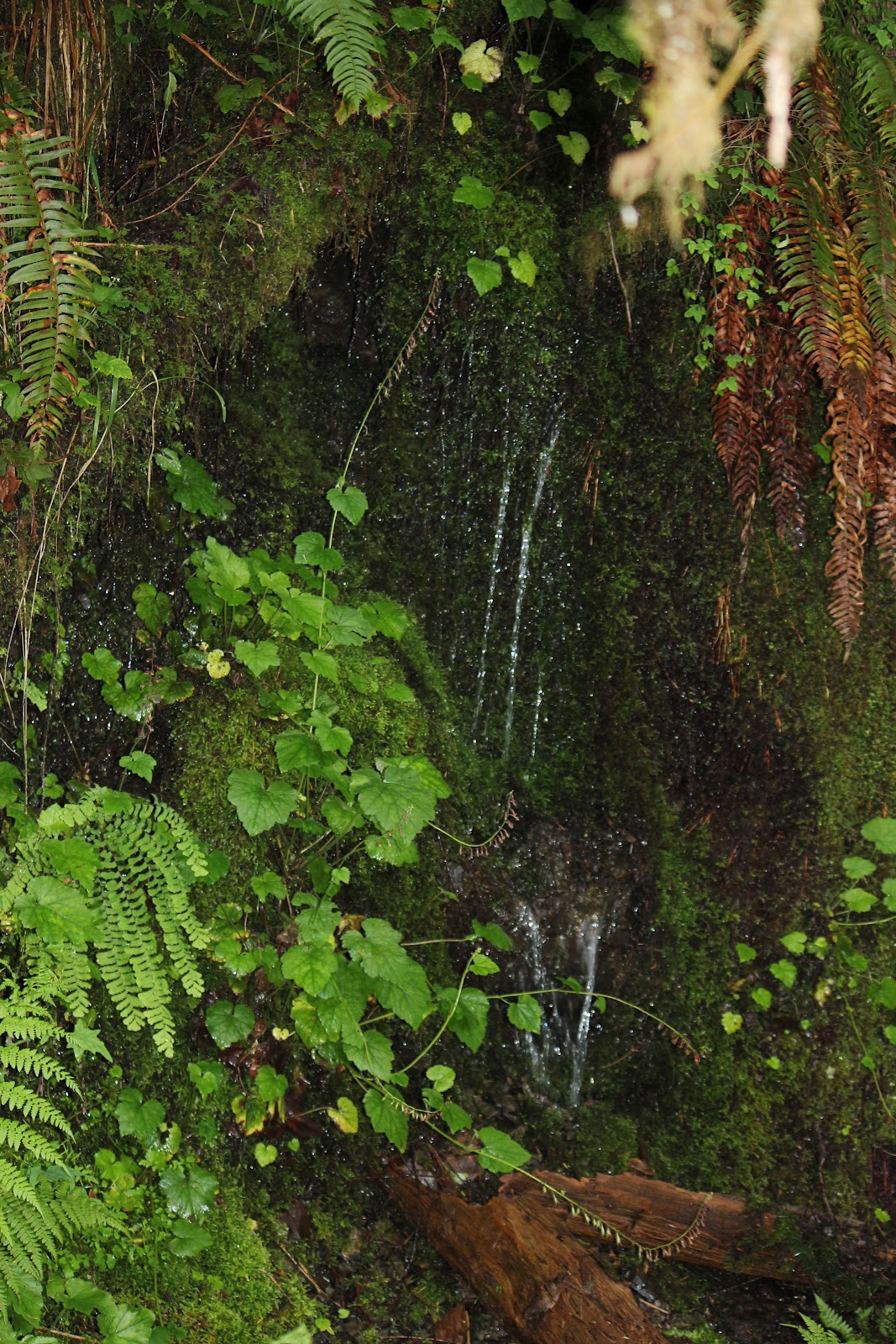
Pretty scenery along the way:


Not a whole lot of flowers in bloom, but I spotted a few:

Foxglove

Red Columbine - the only one I saw, growing down by the river.


Baldhip Rose

A little green frog we spotted
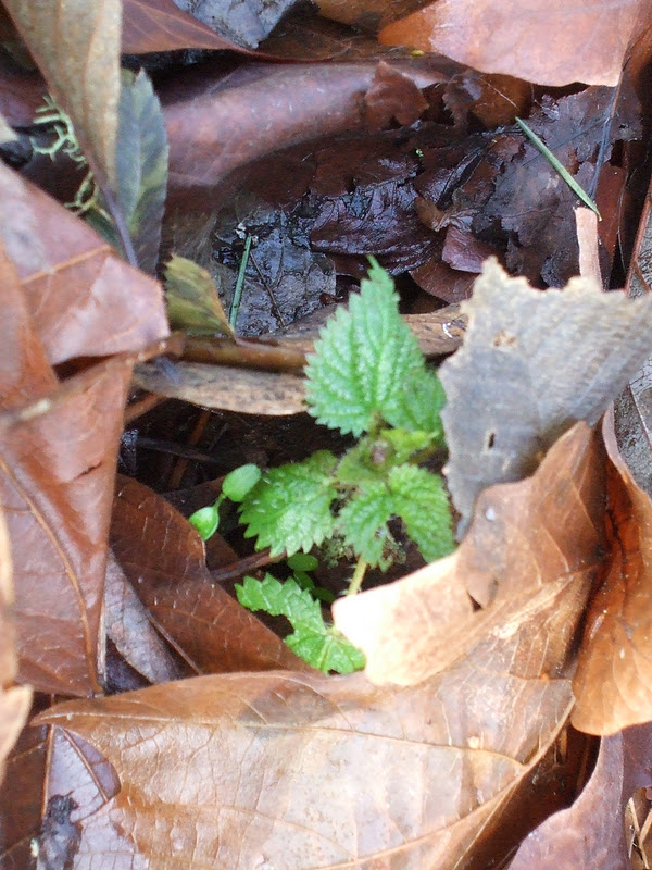
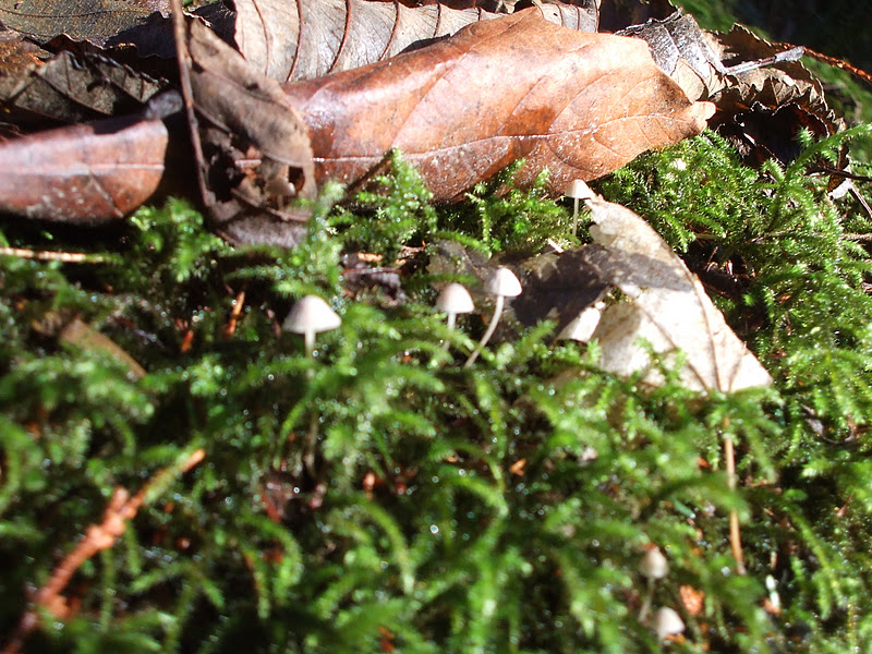
Fungus pictures:
Slug finishing a snack

Oyster Mushrooms, I think.

Pretty sure these are Eyelash Cup fungus. See the eyelashes around the edges?

I think these are Yellow Tuning Fork mushrooms


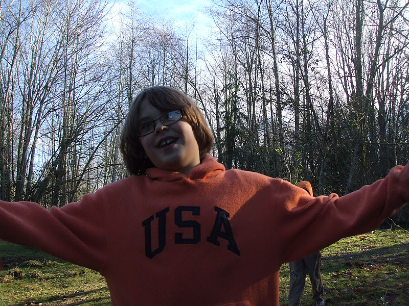
And...here is a big happy trails to you from a tree monster along the trail!

Saturday, May 5, 2012

Pilchuck Tree Farm Trail - March 8th 2012

I ran across Craig Romano's article about hiking at the Pilchuck Tree Farm. It was some place that I had never heard of before and just what I was looking for!


I followed the directions on the above link. He gave great directions on how to get to the Tree Farm and a great 3 mile trek on the forest roads within the tree farm. These roads are accessible all year round, whereas the trails are only for use between May 1st and October 31st. We parked on the side of the road and were careful not to block any of the horse trailer parking areas. It was a bit muddy on the sides of the road, so I parked carefully to make sure I wouldn't get stuck on the way out. The trails and forest roads are used by equestrians and bicycles as well as hikers. We only encountered 2 horses and riders during our hike.


Much to our surprise, we encountered quite a bit of snow on the ground! It made the hike pretty and the kids were excited to see the snow.

The directions for the 3 mile forest road loop that Craig lists on his article are easy to follow. There is some elevation gain, but it is mainly a climb in one area. It was muddy and wet, especially in the open areas. The hike itself was beautiful and I will definitely be doing this one again. I would imagine that the area gets pretty busy on the weekends and summers.

Do keep in mind that this is a privately operated tree farm and the owners of the land are gracious enough to allow people to use it. Please follow all of the required rules including keeping your dog leashed at all times. For any updates about the trails you can check this website.

There are some pretty views along the forest roads as you walk.


In this picture you can even see Mt. Rainier in the distance. I bet it would be spectacular on a really sunny day!
I spotted a bird's nest

This lichen caught my eye

I didn't see too much color, aside from this Holly

At the end of the hike, we spotted several caterpillars
Hope you enjoy the spring hiking! Happy Trails.

Megan

Wednesday, January 11, 2012

Lord Hill Regional Park ~ January 10, 2012

We picked the most gorgeous day for a hike at Lord Hill! There were clear, blue skies and sunshine.

Here you can see the blue sky, as well as my son with a deer-in-the-headlights look!


There were 3 cars in the parking lot when we arrived at 11am. 2 people were leaving and I saw several people just setting off for a trail run. This is a multi-use trail and can be used by hikers, bicyclists and equestrians. We encountered a couple of people hiking with their dogs. Even though we didn't see any horses this time, there is evidence along the trail that they had been there recently - hoof prints and horse droppings. So do watch where you step, as we also saw several piles of dog waste that some thoughtless dog owners failed to pick up.

I love this park because it is so close to home (30 minutes), yet it feels like you are up in the mountains. There are a couple of viewpoints where you can see quite a distance on a clear day. Maps were available at the trailhead, although you could print one ahead of time just to make sure that you have one with you. There was plenty of mud on the trails, so be sure to wear appropriate boots or shoes. We brought a lunch and hiked out of the parking lot on the Main Trail. We cut off on the West View Trail and walked until we reached the viewpoint. The elevation is  not terribly high at 650 feet, and it doesn't give you much of a view during the spring, summer and fall months, but......if you go in the winter when the leaves are off the trees you actually get a decent view of the surrounding countryside! There is also a picnic table and bench at this location, so it makes a nice spot to stop and eat lunch.

The kids had fun playing on a gravel pile where we stopped for lunch.

This is the bench from the viewpoint that I talked about.


After we ate, we walked back the way that we came and headed back to our cars.

There was not much in the way of blooming things or fungus. I did take a couple of pictures though.

I found some brand new stinging nettle peeking through
the leaf litter.

These tiny mushrooms were growing along the trail on some dead wood.
Happy Trails!

Saturday, September 10, 2011

Meadowdale Beach Park Trail ~ September 8th 2011

This was the first time that I had been to Meadowdale Beach Park. It was a great short hike .The trip to the beach is all downhill and you get a good cardio burn on the trip back up. It's 2.5 miles round trip. We saw lots of people and dogs on the trail. The parking lot was almost full at 11:15am when we got there. The kids had a great time playing in the creek along the trail, exploring the beach and going under the tunnel when the train went by!


I loved this sign along the trail:
Happy Trails!

Friday, September 9, 2011

Peek-a-boo Lake ~ August 27th 2011

Peek-a-boo Lake is a trail that I have been wanting to hike for a while now. I finally got around to doing it! We camped at Squire Creek Campground and the trailhead wasn't too far from the campground.

The drive up the forest roads was interesting. You are going to turn west off of the Mountain Loop Highway onto USFS Rd. 2080. This is very near MP 45 and the Sauk River bridge. Continue up USFS Rd. 2080 for a little over a mile and then turn right onto USFS Rd. 2081 - stay on 2081. You will come to a junction with USFS Rd. 2083 and you will need to turn right to stay on 2081. Follow this through weeds growing up and brushing under your car. I thought we were on the wrong road for a while. This road gets steep and I lost traction a couple of times driving up an incline in the gravel. My husband played classical music the whole way up to help him relax if that helps to paint the picture. :-)


You will stay on 2081 for approximately 3.5 miles before you get to a junction with USFS Rd. 2086, bear left on this and continue for another mile until you reach the roads end and the trailhead. I was surprised to see 6 or 7 other vehicles at the trailhead when we parked at around noon as the road did not appear to have been traveled much recently. The trail begins where the road dead ends.


I know there are more difficult trails, but this one was far from easy! It gave everyone a good workout. It's about 5 miles roundtrip with 1500 ft. of elevation gain. Lots of beautiful scenery along the trail.

Many switchbacks to walk up as well some places that seemed to just go straight up. Watch out for slippery spots especially on the way down. We encountered some wet and muddy areas especially as we got into the meadow area where the snow was still melting.

The first patch of snow we encountered


Making a sliding trail in the snow with his feet
After hiking upward for about 2 miles you come to the meadow and the melting snow. After that you drop back down about 300 feet until you reach the lake.


The melting snow with plants pushing up through it made it look like spring!


Pictures of the lake:


Hiking back up to the meadow from the lake
Another meadow picture as we walked out to the viewpoint 

We went out to the viewpoint after we went to the lake. Keep children and dogs close here as there is a very steep drop off. The path out to the viewpoint is lined with wild blueberries (not ripe yet though).


The kids decided to try to cross one of the little muddy ponds in the meadow. Luckily
no one got wet!

Heading back down the trail - Gavin decided to run because it was downhill....

and the end result of running down a trail and catching a slick spot. You slide
off the trail and gouge yourself on a sharp branch.

Still smiling (after the initial tears)....thankfully!

Flowers, fungus and frogs (and toad):


 Happy Trails!