Well, here goes my hiking aspirations for the coming year! In no particular order. :-) Please comment if you have suggestions, reviews or corrections.
Meadowdale Beach Park
Roundtrip: 2.5 miles
Difficulty: moderate
Drive time (from North Everett): 30 minutes
Parking Pass required: No
Mercer Slough Nature Park - More here
Roundtrip: 6 miles of trails
Difficulty: Easy
Drive time (from N. Everett): 40 minutes
Parking Pass required: No
Wallace Falls State Park - WTA link -done
Roundtrip: 5.5 miles
Difficulty: moderate to difficult
Drive time (from N. Everett): 45 minutes
Parking Pass required: Discover Pass
Bridal Veil Falls
Roundtrip: 5 miles
Difficulty: moderate
Drive time (from N. Everett): 50 minutes
Parking Pass required: Recreation Pass required
Iron Goat Trail
Roundtrip: Variable - up to 10+ miles
Difficulty: Moderate
Drive time (from N. Everett): 1 hour 20 minutes approx to Iron Goat Trail Interpretive Site Trailhead
Parking Pass required: Recreation Pass required
Big Gulch Trail - Yelp trip report -done
Roundtrip: 2 miles
Difficulty: moderate
Drive time (from N. Everett): 15 minutes
Parking Pass required: No
Japanese Gulch Trail - Maps - more info -done
Roundtrip: 14 miles of trails total
Difficulty:easy - difficult
Drive time (from N. Everett):15-20 minutes
Parking Pass required: No
Lake Twenty-Two
Roundtrip: 4-5 miles roundtrip
Difficulty: moderate - steep
Drive time (from N. Everett): one hour approx.
Parking Pass required: Recreation Pass required
Ashland Lakes
Roundtrip: 5.5 miles
Difficulty: easy terrain - longer distance though
Drive time (from N. Everett): 1 hour 15 minutes
Parking pass required: No
Bob Heirman Wildlife Preserve
Roundtrip: 3 miles
Difficulty: easy
Drive time (from N. Everett): 25 minutes
Parking pass required: No
Rockport State Park
Roundtrip: 3 miles
Difficulty: Easy - moderate
Drive time (from N. Everett): 1 hour 25 minutes
Parking pass required: Discover Pass
Sauk Mountain
Roundtrip: 4.2 miles
Difficulty: moderate - difficult
Drive time (from N. Everett): 1 hour 50 minutes
Parking pass required: No
Cougar Mountain - Past hike there
Roundtrip: Varied - 36 miles of trails
Difficulty: easy - difficult
Drive time: (from N. Everett): 55 minutes
Parking pass required: No
Brightwater Center -done
Roundtrip: 3 miles of trails
Difficulty: easy - moderate
Drive time (from N. Everett): 30 minutes
Parking pass required: No
Rasar State Park
Roundtrip: 3.7 miles
Difficulty: easy - moderate
Drive time (from N. Everett): 1 hour 15 minutes
Parking pass required: Discover Pass
Paradise Valley Conservation Area
Roundtrip: varies - 13 miles of trails
Difficulty: easy - difficult
Drive time (from N. Everett): 35 minutes
Parking pass required: No
Lime Kiln Trail -done
Roundtrip: 7 miles
Difficulty: moderate
Drive time (from N. Everett): 35 minutes
Parking Pass required: No
Canyon Lake Trail
Roundtrip: 6 miles
Difficulty: moderate
Drive time (from N. Everett): 1 hour 15 minutes
Parking pass required: No
Pinnacle Lake Trail
Roundtrip: 3.8 miles
Difficulty: Difficult
Drive time (from N. Everett): 1 hour 20 minutes
Parking pass required: Recreation Pass required
Carkeek Park
Roundtrip: 6 miles
Difficulty: easy - moderate
Drive time (from N. Everett): 35 minutes
Parking Pass required: No
Franklin Falls
Roundtrip: 2 miles
Difficulty: easy
Drive time (from N. Everett): 1 hour 25 minutes
Parking Pass required: Recreation Pass required
Twin Falls
Roundtrip: 3 miles
Difficulty: easy - moderate
Drive time (from N. Everett): 1 hour and 10 minutes
Parking Pass required: No
Boulder River
Roundtrip: 2.5 to 8.6 miles
Difficulty: easy to moderate
Drive time (from N. Everett): 1 hour 10 minutes
Parking Pass required: No
Talapus Lake Trail
Roundtrip: 4 miles
Difficulty: Difficult - steep
Drive time (from N. Everett): 1hour 20 minutes approx.
Parking pass required: Recreation Pass required
Little Mountain Park - Mt. Vernon - WTA link
Roundtrip: 4 miles of trails in total
Difficulty - moderate
Drive time (from N. Everett): 45 minutes
Parking pass required: No
Little Cranberry Lake
Roundtrip: miles of trails
Difficulty: easy - moderate
Drive time (from N. Everett): 1 hour 5 minutes
Parking pass required: No
Whistle Lake - more info
Roundtrip: miles of trails
Difficulty: easy - difficult
Drive time (from N. Everett): 1 hour
Parking pass required: No
Heart Lake
Roundtrip: miles of trails
Difficulty: easy-difficult
Drive time (from N. Everett): 1 hour
Parking pass required: no
Thursday, January 19, 2012
Wednesday, January 11, 2012
Lord Hill Regional Park ~ January 10, 2012
We picked the most gorgeous day for a hike at Lord Hill! There were clear, blue skies and sunshine.
There were 3 cars in the parking lot when we arrived at 11am. 2 people were leaving and I saw several people just setting off for a trail run. This is a multi-use trail and can be used by hikers, bicyclists and equestrians. We encountered a couple of people hiking with their dogs. Even though we didn't see any horses this time, there is evidence along the trail that they had been there recently - hoof prints and horse droppings. So do watch where you step, as we also saw several piles of dog waste that some thoughtless dog owners failed to pick up.
I love this park because it is so close to home (30 minutes), yet it feels like you are up in the mountains. There are a couple of viewpoints where you can see quite a distance on a clear day. Maps were available at the trailhead, although you could print one ahead of time just to make sure that you have one with you. There was plenty of mud on the trails, so be sure to wear appropriate boots or shoes. We brought a lunch and hiked out of the parking lot on the Main Trail. We cut off on the West View Trail and walked until we reached the viewpoint. The elevation is not terribly high at 650 feet, and it doesn't give you much of a view during the spring, summer and fall months, but......if you go in the winter when the leaves are off the trees you actually get a decent view of the surrounding countryside! There is also a picnic table and bench at this location, so it makes a nice spot to stop and eat lunch.
After we ate, we walked back the way that we came and headed back to our cars.
There was not much in the way of blooming things or fungus. I did take a couple of pictures though.
Happy Trails!
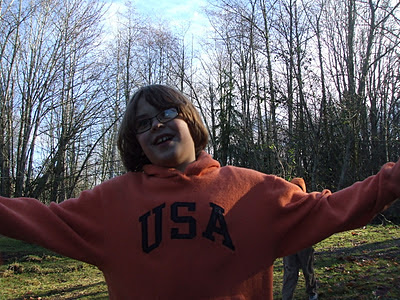 |
| Here you can see the blue sky, as well as my son with a deer-in-the-headlights look! |
There were 3 cars in the parking lot when we arrived at 11am. 2 people were leaving and I saw several people just setting off for a trail run. This is a multi-use trail and can be used by hikers, bicyclists and equestrians. We encountered a couple of people hiking with their dogs. Even though we didn't see any horses this time, there is evidence along the trail that they had been there recently - hoof prints and horse droppings. So do watch where you step, as we also saw several piles of dog waste that some thoughtless dog owners failed to pick up.
I love this park because it is so close to home (30 minutes), yet it feels like you are up in the mountains. There are a couple of viewpoints where you can see quite a distance on a clear day. Maps were available at the trailhead, although you could print one ahead of time just to make sure that you have one with you. There was plenty of mud on the trails, so be sure to wear appropriate boots or shoes. We brought a lunch and hiked out of the parking lot on the Main Trail. We cut off on the West View Trail and walked until we reached the viewpoint. The elevation is not terribly high at 650 feet, and it doesn't give you much of a view during the spring, summer and fall months, but......if you go in the winter when the leaves are off the trees you actually get a decent view of the surrounding countryside! There is also a picnic table and bench at this location, so it makes a nice spot to stop and eat lunch.
 |
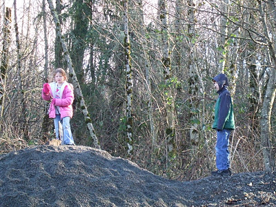
| The kids had fun playing on a gravel pile where we stopped for lunch. |
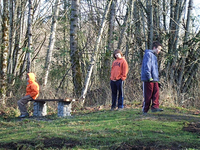 |
| This is the bench from the viewpoint that I talked about. |
After we ate, we walked back the way that we came and headed back to our cars.
There was not much in the way of blooming things or fungus. I did take a couple of pictures though.
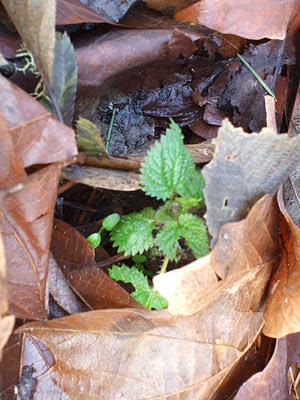 |
| I found some brand new stinging nettle peeking through the leaf litter. |
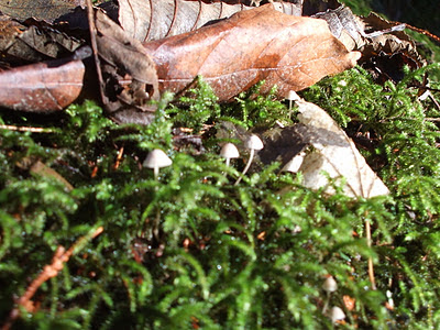 |
| These tiny mushrooms were growing along the trail on some dead wood. |
Tuesday, January 3, 2012
Paradise Valley Conservation Area ~ December 1, 2011
We went for a very chilly hike at the Paradise Valley Conservation Area. I think temperatures stayed in the 30 degree range while we hiked! There was a lot of fog as well. It was nice to be outside and get some exercise and fresh air though, despite the cool weather.
I haven't been to this area before, but I will definitely be back. I printed a map to bring with me as this is one of those places that has a variety of looping trails.
We walked from the parking lot on the mainline trail and cut off on the Wetland Plateau Trail. We ate lunch where the trail ended at the Southern Traverse Trail and then turned around and headed back the way we came. We walked almost 2 miles round trip. This was plenty long as everyone was ready to warm up when we got back to the parking lot!
We encountered some mud on the trail, one viewpoint of Mt. Baker that would have been nice if we weren't fogged in, several other hikers and a couple of leashed dogs.
The brochure (found in the map link above), says that the parking lot can be full on busy weekends. I would save this hike for the off season or weekday times to avoid the crowds.
Found lots of very large, yellow leaves. I think they are Black Cottonwood? Someone correct me if I'm wrong. :)
I also noticed many pieces of wood and branches that had hair ice on them. I've never seen anything like it. It was really pretty. At first I thought it was some kind of slime mold or fungus.
Here are the fungus pictures:
I thought this was a cool picture of the leaf stabbed on a sharp branch.
Happy trails!
Subscribe to:
Comments (Atom)
